For service in the Atlanta, Georgia area contact or call us:
The Purpose of Construction Surveys
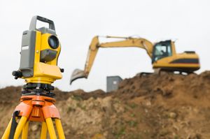
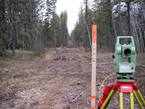
Construction surveys, sometimes called construction staking, have a valuable purpose. Reliable construction stakeouts insure the correct placement of the buildings, utilities and other improvements on the site. The Superintendent can have peace of mind knowing that all the pieces will fit correctly on the job site.

What are Construction Surveys?
Construction surveys are needed to determine the vertical and horizontal control for a construction project. All buildings, roadways, drive entrances, curb and gutter, sanitary sewer lines and storm drainage structures should be located by a competent land surveyor.

How to Survey Safely on Construction Sites
My experience on a survey stakeout crew goes back more than 30 years. I have had the opportunity to be exposed to slow-moving as well as fast moving equipment in work zones. Operators on large earth moving equipment often have difficulty seeing a surveyor standing on the ground. Stakeout crews must be alert at all times to moving equipment especially to backing equipment.
It was always our policy for each crew member to wear appropriate safety helmets and reflector vests within the project limits. In a busy work zone, it is good practice to have an observer standing by the person setting the stakes in the ground to be on lookout for moving equipment.

Communication in Construction Surveys
The staking crew must meet with the project superintendent before the work begins on a project. This gives the superintendent an opportunity to know the survey crew personnel and for him to explain what he will be needing for stakes and the expected construction schedule.
The party chief and the superintendent always discuss the way construction stakes will be marked. Some of the procedures discussed are:
- Will stakes be offset from the back of the curb or to the face of the curb?
- Do you set offset stakes to the inside of an inlet or to the inside face of the inlet?
- What is your color code for stake flagging?
- What offset distance do you need for the centerline stakes?

Poor communication between the project superintendent and the survey party chief can be quite costly if they do not understand each other! On a project several years ago, the stakeout crew set his offset stakes from the back of the curb and the grading crew interpreted the stakes as offset from the face of the curb. This created a mistake of 1-foot of road pavement width for 2 miles of roadway. To say the least, the owners were not happy. The curb and gutter had to be removed and re-poured. It not only cost for reconstruction but it also cost in time lost on the job.
Grade Stakes
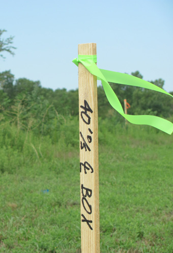
We set grade stakes for vertical elevations for the site grading contractor. The surveyor takes the horizontal and vertical control from the construction plans to determine the exact location and elevation of each point to be staked. He then locates the position in the field and marks the construction stakes for the contractor.
Often the contractor needs preliminary subgrade stakes to rough grade the site. The surveyor sets preliminary subgrade stakes on an offset so that the grade stakes will not be disturbed by the equipment doing the initial grading.
First, the surveyor identifies the depth of the cut and fill sections on the site. Some of our contractors ask for these stakes to be marked to the nearest tenth of a foot. If the grading contractor has a cut of 10 feet, he will grade the cut section to the approximately elevation. Then our crew will re-stake the area to the subgrade elevation shown on the plans.
During rough grading operations, the superintendent will notify the party chief of the information needed on the grade stakes. The surveyor sets those stakes by using the horizontal control shown on the plans. The surveyor is careful to offset the stakes from the immediate construction area.
The construction superintendent, not the surveyor, makes the decision as to how many and where grade stakes are required. Construction surveys are to aide the superintendent and to make the construction activities flow smoothly.
Utility and Drainage Structure Staking
Construction surveys and location of drainage structures are important functions of any construction project. During the initial topographic survey, the surveyor will carefully evaluate all potential site drainage problems. It is critical that sufficient data be gathered by the surveyor for the drainage engineer to perform a good design.
Adequate drainage structures are critical for proper drainage of the site. Improperly designed and located drainage structures will cause on-going problems during the operation of the facility.
The survey crew uses the site plans to locate the position of the new storm drainage pipe. He then stakes the location of the pipe and sets cut stakes for the piping contractor. The cut stakes tells the superintendent how deep to dig his trench for the pipe and where to locate manholes and junction boxes.
The term invert is often used interchangeable with such other terms as flow line grade, pipe invert grade and grade line elevation. They usually mean the same thing to most contractors. It is the elevation of the low point on the inside circumference of the pipe.
Construction surveys are valuable services for every construction project.
Link to the National Society of Professional Surveyors (NSPS): www.nsps.us.com
Link to the Surveying and Mapping Society of Georgia: www.samsog.org
For more information about land surveying read the following articles:
Atlanta Engineering Services' Home Page
Land Surveying in Atlanta, Georgia
Portfolio of Atlanta Engineering Services Surveys
Professional Land Surveyors in Alpharetta, Georgia
Restaurants and Taverns must have a Beverage License Survey
Forensic Scene Mapping for Traffic Accidents
Topographic Surveys for Land Development
G-ZNJ8QW23K9